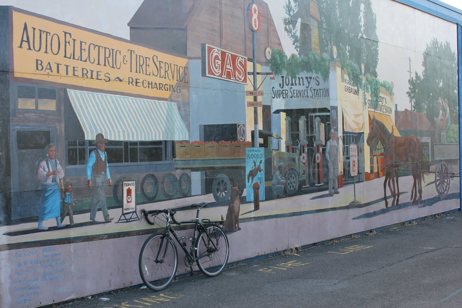
 Best time is theatre time...AND bicycle time!
Photo taken August 1, 2011 in Crookston, MN
Best time is theatre time...AND bicycle time! Natural Bridges National Monument is located in Southeast Utah near the Arizona border. The nearest town is Blanding, UT.
 The above "natural bridge" is called Sipapu Bridge. The bridge is 220 feet high and spans 268 feet across. There are 3 natural bridges in the monument.
 The area became known to the American public via a National Geographic Magazine article published in 1904. The area became a National Monument in 1908 designated by Theodore Roosevelt. The first paved road leading to the monument from Blanding was built in the mid 70's. Until then, the monument had very few visitors. During my visit I spoke to a DNR representative. He mentioned that even today the monument only averages 20-25 vehicles per day. This wasn't a surprise to me as the monument is in the middle of nowhere and I found it by accident after getting lost trying to find my way to Blanding from Monument Valley in Arizona.
 Just as cool as the bridges is White Canyon itself where the bridges were formed by roaring white water.


 Above, the two prominent buttes are called "Bear Ears". Several Native American groups consider the area sacred and include "bear ears" in their oral traditions. The left butte is 8930 feet above sea-level. The right is 9058 feet above sea-level.
 "Anything that lives where it would seem that nothing could live, enduring extremes of heat and cold, sunlight and storm, parching aridity and sudden cloudbursts, among burnt rocks and shifting sands, any such creature, beast, bird, or flower, testifies to the grandeur and heroism inherent in all forms of life. Including the human. Even in us." ~ Edward Abbey
 Formal recognition for the White Sands came on January 18, 1933 when President Herbert Hoover proclaimed the area a National Monument.
 These photos were taken June 2011 on my third visit to White Sands. Simply stated, it was very hot during my third visit. The temperature read 105 degrees on my vehicle dashboard when I started my hike across the dunes. Two hours later I returned to my vehicle drenched in sweat and out of water. The temperature gage now read 107 degrees. It seemed much hotter. When I stopped at the visitor center to purchase some cold water I mentioned the temperature to a park ranger. The ranger said that I could add 20-25 degrees to whatever my temperature gage read. She continued to say that the white sands reflect the suns rays best during the summer months.
 Although it can be hot, White Sands National Monument is the coolest place to explore in the Southwest.
 White Sands is located in New Mexico in the heart of Tularosa Basin. Here the dunes have engulfed 275 square miles.

 When riding a bicycle there is no need for electricity, fuel, and hay.
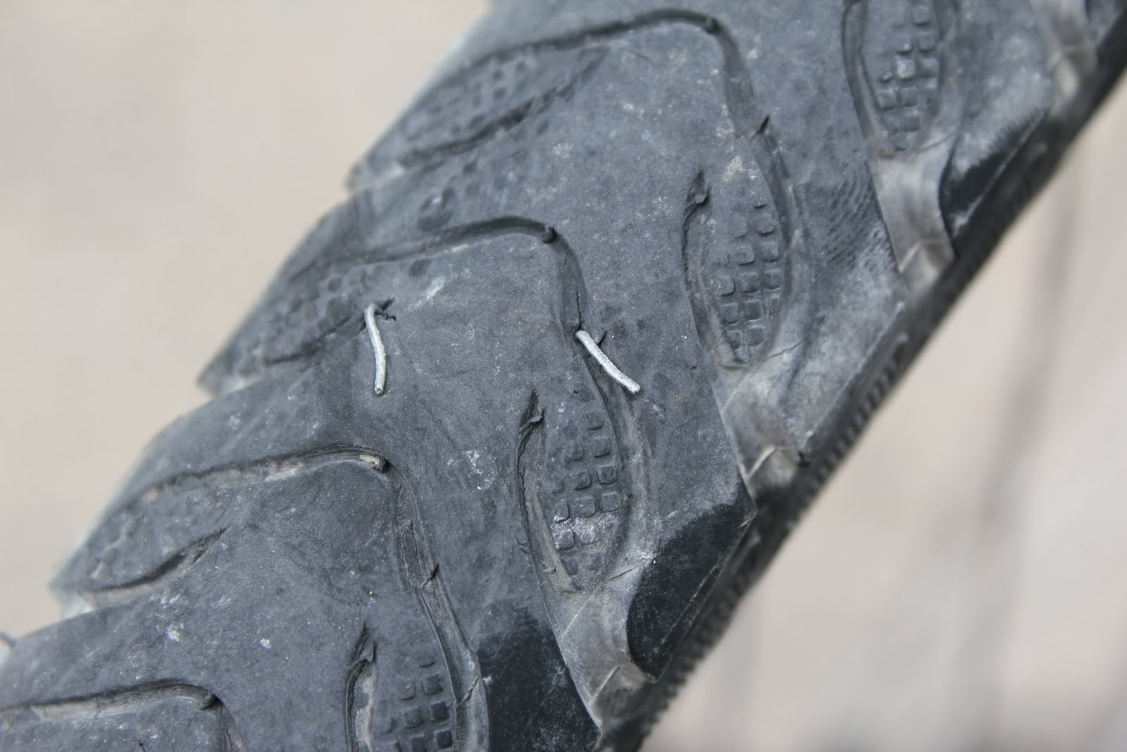 What are the chances of getting a flat tire on the the same stretch of road by the same puncture method exactly 2 years to the day apart?
 Rockport State Park is in Skagit County, Washington. The park consists of 670 acres and has countless tall and impressive Douglas fir trees. The Douglas fir is named after David Douglas , a horticulturalist who first studied and collected the tree in 1825. Some of the Douglas fir trees in the park reach over 250 feet tall. The bark on tall Douglas fir trees can be 8-10 inches thick.
 "The trees...form one of the most striking and truly graceful objects in Nature." ~ David Douglas on the Douglas fir tree
 The trees in the park are part of an ancient forest. The old growth was never logged and the entire ecosystem remains in place.
 Some of the largest leafs I've ever seen.
 The canopy is so dense that only minimal sunlight can pass through to hit the ground. Because of this ferns dominate the ground and moss covers most of the smaller trees.


 The "Welcome to Concrete" signage is only included because I like it and the photo doesn't really fit in in another post. Rockport State Park is located on Hwy 20 between Rockport and Concrete.


